


13 Le Rove carbonière Baou 2 croix Esclades bis

Nathy8913
User
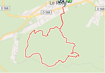

Length
6.3 km

Max alt
240 m

Uphill gradient
188 m
Km-Effort
8.8 km

Min alt
139 m

Downhill gradient
189 m
Boucle
Yes
Creation date :
2025-03-13 12:45:32.991
Updated on :
2025-03-15 15:21:11.613
2h00
Difficulty : Medium

FREE GPS app for hiking
 SityTrail
IGN / Geographical institutes
SityTrail Plus
The world is yours!
About
Trail Walking of 6.3 km to be discovered at Provence-Alpes-Côte d'Azur, Bouches-du-Rhône, Le Rove. This trail is proposed by Nathy8913.
Positioning
Country:
France
Region :
Provence-Alpes-Côte d'Azur
Department/Province :
Bouches-du-Rhône
Municipality :
Le Rove
Location:
Unknown
Start:(Dec)
Start:(UTM)
682440 ; 4804177 (31T) N.
Comments